Intensive mining has caused the terrain and surface to sink so substantially in some areas in the Ruhr area that large depressions have formed – referred to as polder areas. In these areas, waterways cannot always flow freely anymore. The “lower” areas therefore need to be continuously artificially drained to prevent the accumulation of water from rivers and lakes. These processes have a big impact on the overall water balance in the region. In a new project, the Research Center of Post-Mining (FZN) at TH Georg Agricola University (THGA), Bochum/Germany, is therefore investigating how water management in the Ruhr area can be made more sustainable. Any resulting measures could particularly benefit the farmers and the forests in the region. The planned environmental monitoring should also improve the management of extreme events, such as heavy rainfall or long periods of drought. This is where the “MuSE” project (Multi-sensor geomonitoring for sustainable polder management) comes in.
MuSE is being funded by RAG-Stiftung until 2024. Bärbel Bergerhoff-Wodopia, Member of the Board of Management at RAG-Stiftung, stresses: “At RAG-Stiftung, we believe we have a responsibility to find solutions to the challenges that mining has left behind. With this in mind, we are working closely with THGA and the Research Center of Post-Mining and are supporting the “MuSE” project with firm conviction.”
“In areas where the land has sunk as a result of coal mining, that is where large depressions have formed in the ground, the soil moisture has also changed,” explains Prof. Tobias Rudolph from the FZN. In some cases, entirely new bodies of water have been created, like Weihnachtssee lake or Ewaldsee lake in Herten (Figure 1). “This naturally has an impact on the use of land and resources for agriculture, forestry and water management. This has far-reaching consequences – particularly because of climate change,” says the geomonitoring expert. The lower levels of precipitation and increased periods of drought over recent years have made this clear: “The Ruhr area needs more water in order to cope with the effects of climate change in the long term – even if the events of the last few weeks may cause you to think otherwise.”
Prof. Rudolph and his team are therefore investigating alternative solutions for the management of polder water drainage, namely: “What can we do to make better use of this water? And how can we optimise irrigation planning in general?” In the new MuSE research project, the experts at the FZN are investigating how to redesign polder management so that it is efficient and sustainable. Higher groundwater levels and the economic and technical use of elevated groundwater and surface water, e. g., could help to minimise drought damage in agriculture and forestry. Targeted monitoring can also help ensure that polder areas are better set up to cope with heavy rainfall and flooding.
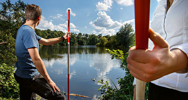
To this end, not only are the experts at the FZN analysing the historic data available, they are also using modern satellite data and performing their own measurements in selected test areas: “We use various sensors to measure the soil moisture. We also analyse water level data and survey the vegetation using our drones, examining the health of the plants at the same time. We combine this information that we have gathered locally with remote sensing data supplied by the European satellite programme Copernicus and evaluated for the first time with regard to this issue,” explains Xiaoxuan Yin, a specialist in radar interferometry and remote sensing who joined the FZN in order to work on the project.
Then it gets a bit trickier: “We combine all the different pieces of information in a 4D model using time as the fourth dimension,” explains Yin. This enables the scientists to track the changes in the water balance over the decades and model these changes digitally. “Ideally, this will enable us to make recommendations on long-term land and resource usage and help to improve the environmental conditions in agriculture, forestry and water management.” (THGA/Si.)